How is groundwater replenished?

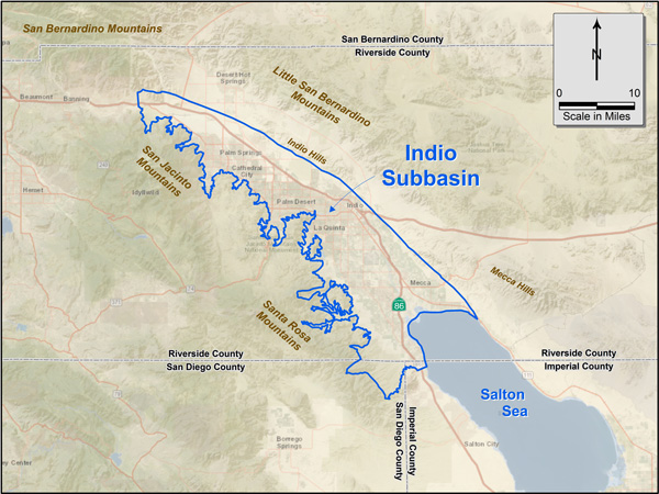
Groundwater basins can be replenished naturally and artificially when water from the surface is allowed to seep into the soil. The Indio Subbasin is replenished naturally with mountain precipitation that flows downstream to the Whitewater River. Water agencies in the Coachella Valley also artificially replenish the groundwater with imported water that is pumped into what are known as “recharge ponds” and allowed to seep into the ground.

What is a groundwater basin?

A groundwater basin is made up of several layers of aquifers, typically separated by different soil or rock types. Water fills the spaces under clay and in between the sand and gravel. Water within the Indio Subbasin slowly moves from the upper valley in the northwest towards the Salton Sea in the southeast.

What is an aquifer?

An aquifer can be thought of as an underground reservoir for groundwater. An aquifer is a layer of rock or sediment that stores water in the spaces between sand, soils, and fractured rock. Groundwater stored in deep aquifers have accumulated over centuries or millennia.

What is the Indio Subbasin?

The Indio Subbasin is part of the Coachella Valley Groundwater Basin, which is designated as Basin No. 7-12.01 in the DWR Bulletin 118 (DWR, 2003). See map below. The basin is surrounded by the San Bernardino Mountains on the north, the San Jacinto and Santa Rosa Mountains on the west, the Little San Bernardino Mountains on the east and the Salton Sea on the south. Adjacent groundwater subbasins are also shown in the map below.

Figure 1. Indio subbasin regional map